Karakoram ruggedness pictures
In these pictures we see the region gradually shrink to focus on the Hunza Valley,
the most rugged area of the Karakoram.
NEW: I have created KML files for some of these regions, for use in Google Earth. See the links below.
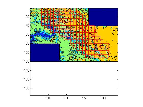
Large version of Karakoram: area = 71900 km^2, rug = 265m.
Shaded region extends from Batura Muztagh at upper left to Saser Muztagh at lower right.
Baltoro Muztagh (K2 etc.) is just right of center.
Nanga Parbat (not in Karakoram) is the notable feature at middle left, south of the Indus Valley.

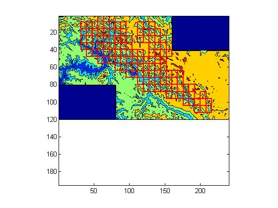
Medium version of Karakoram : area = 65900 km^2, rug = 274m.
Some areas on edge of Tibetan plateau have been excluded.
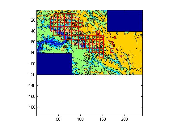
Small version of Karakoram: area = 51000 km^2, rug = 295m.
Many consistently high areas have been excluded.
KML file
Very small version of Karakoram: area = 29300 km^2, rug = 332m.
Region now goes east only to Baltoro and Charakusa Valley.
The core rugged area of the Karakoram: the Hunza Valley
The frame of the pictures below corresponds to the upper left corner of the previous pictures.
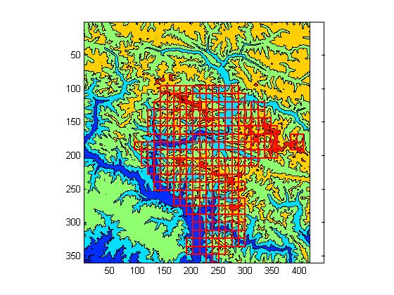
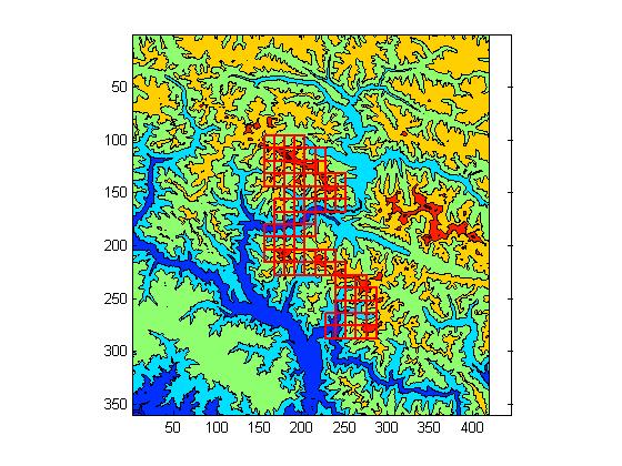
The Hunza Valley: area = 7300 km^2, rug = 410m.
Region includes the Batura Wall (just above center); the Hispar Muztagh (just right of center);
the Rakaposhi-Haramosh groups (just below center); and the junction of the Hunza and Indus Rivers.
KML file
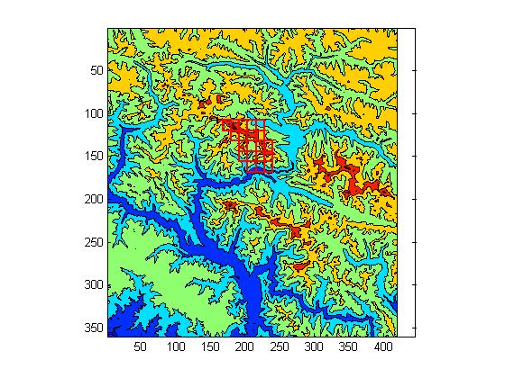
Batura-Rakaposhi-Haramosh: area = 2100 km^2, rug = 456m.
Region includes the Batura Wall and the Rakaposhi-Haramosh groups.
KML file
The Batura Wall: area = 500 km^2, rug = 480m.
Region includes only the central and southeastern Batura Wall.
KML file
Return to ruggedness comparison page