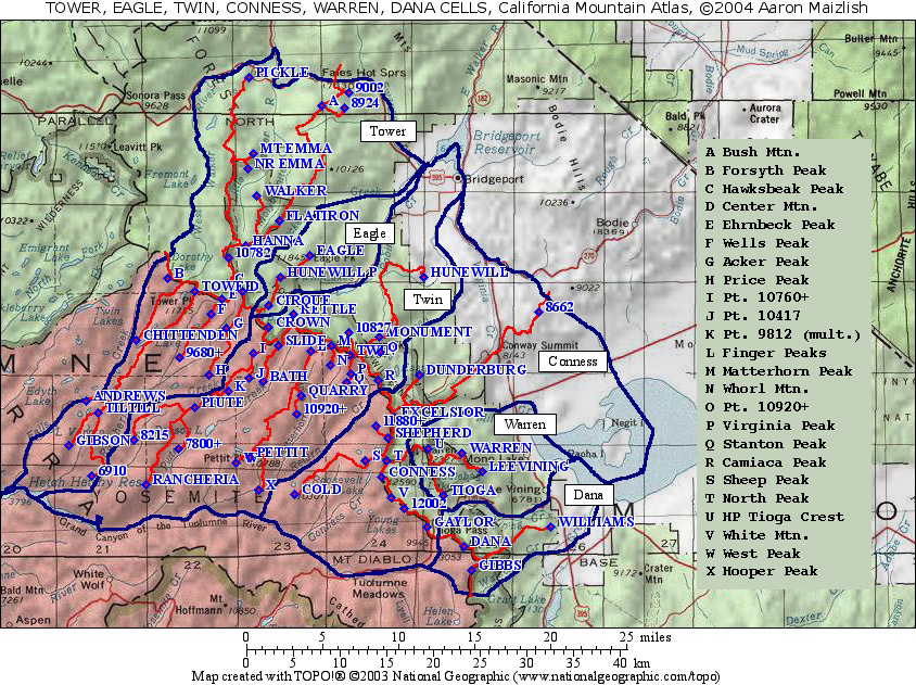
California
Cell Reference Map
California Mountain Atlas
Home Page
Peaklist
Home Page
Notes and Key to
California Mountain Atlas


MOUNT DANA

List of all P500 summits on the cell:

Mt. Dana is a High Sierra peak along the Sierra Crest in Yosemite National Park.  It is one of a group of close Sierra Crest P2000s that can be found on the Mt. Conness map. 

The lineage cell comprises a small area of the Pacific crest from Tioga Pass (Conness KS) at the north to Mono Pass at the south.   Just three summits are in this cell:  Mount Dana and Mount Gibbs on the crest, and Williams Butte, a low eastside summit immediately behind Lee Vining.


Map of all P500 summits on the cell:      Mt. Conness map (includes Dana)


first release:  August 25, 2004
RANK
PEAK ELEVATION E (e) PROMINENCE SADDLE S (e) LAT. LONG.


1
Mt. Dana 13057
2417 10640 40 37˚ 53' 59" N 119˚ 13' 16" W
2
Mt. Gibbs 12773
1093 11680 40 37˚ 52' 37" N 119˚ 12' 43" W
3
Williams Butte 8429
549 7880 40 37˚ 55' 08" N 119˚ 06' 54" W