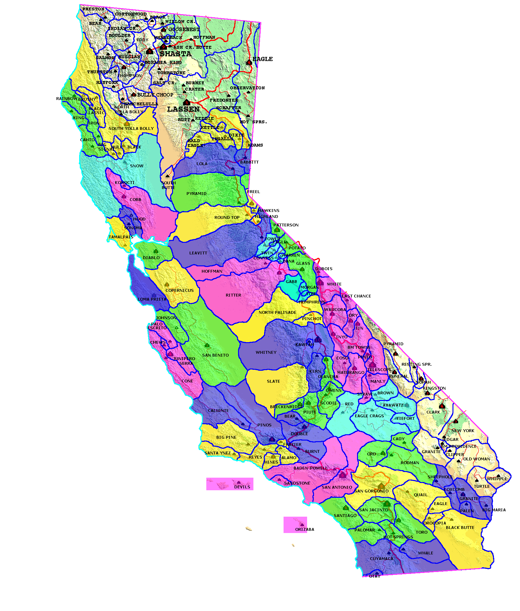
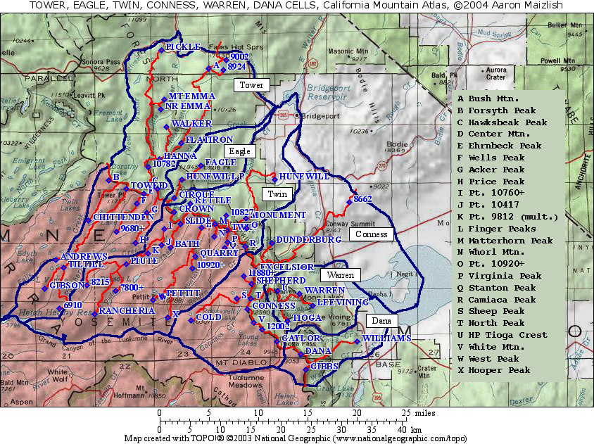
| California Cell Reference Map |
California
Mountain
Atlas Home Page |
Peaklist Home Page |
Notes
and Key to California Mountain Atlas |
| RANK |
PEAK | ELEV | E (e) | PROM | SADDLE | S (e) | LAT | LONG |
| 1 |
Mt. Conness | 12590 | |
2647 | 9943 | |
37˚ 58' 1" N | 119˚ 19' 16" W |
| 2 |
Cold Mtn. | 10301 | |
1541 | 8760 | 40 | 37˚ 57' 2" N | 119˚ 25' 38" W |
| 3 |
Dunderberg Peak | 12374 | |
1334 | 11040 | 40 | 38˚ 3' 52" N | 119˚ 16' 28" W |
| 4 |
Excelsior Mtn. | 12446 | |
1246 | 11200 | 40 | 38˚ 1' 28" N | 119˚ 18' 19" W |
| 5 |
North Peak | 12242 | |
682 | 11560 | 40 | 37˚ 58' 56" N | 119˚ 18' 52" W |
| 6 |
Sheep Peak | 11842 | |
642 | 11200 | 40 | 37˚ 58' 56" N | 119˚ 20' 26" W |
| 7 |
White Mtn. | 12057 | |
617 | 11440 | 40 | 37˚ 56' 49" N | 119˚ 18' 34" W |
| 8 |
HP Shepherd Crest | 12000 | 40 | 520 | 11480 | 40 | 38˚ 0' 17" N | 119˚ 18' 46" W |
| 9 |
Pt. 11880+ | 11880 | 40 | 520 | 11360 | 40 | 38˚ 0' 56" N | 119˚ 19' 39" W |
| 10 |
Pt. 8662 | 8662 | |
514 | 8148 | |
38˚ 7' 29" N | 119˚ 7' 49" W |
| 11 |
Gaylor Peak | 11004 | |
484 | 10520 | 40 | 37˚ 55' 8" N | 119˚ 15' 56" W |
| 12 |
Pt. 12002 | 12002 | |
482 | 11520 | 40 | 37˚ 56' 12" N | 119˚ 17' 35" W |