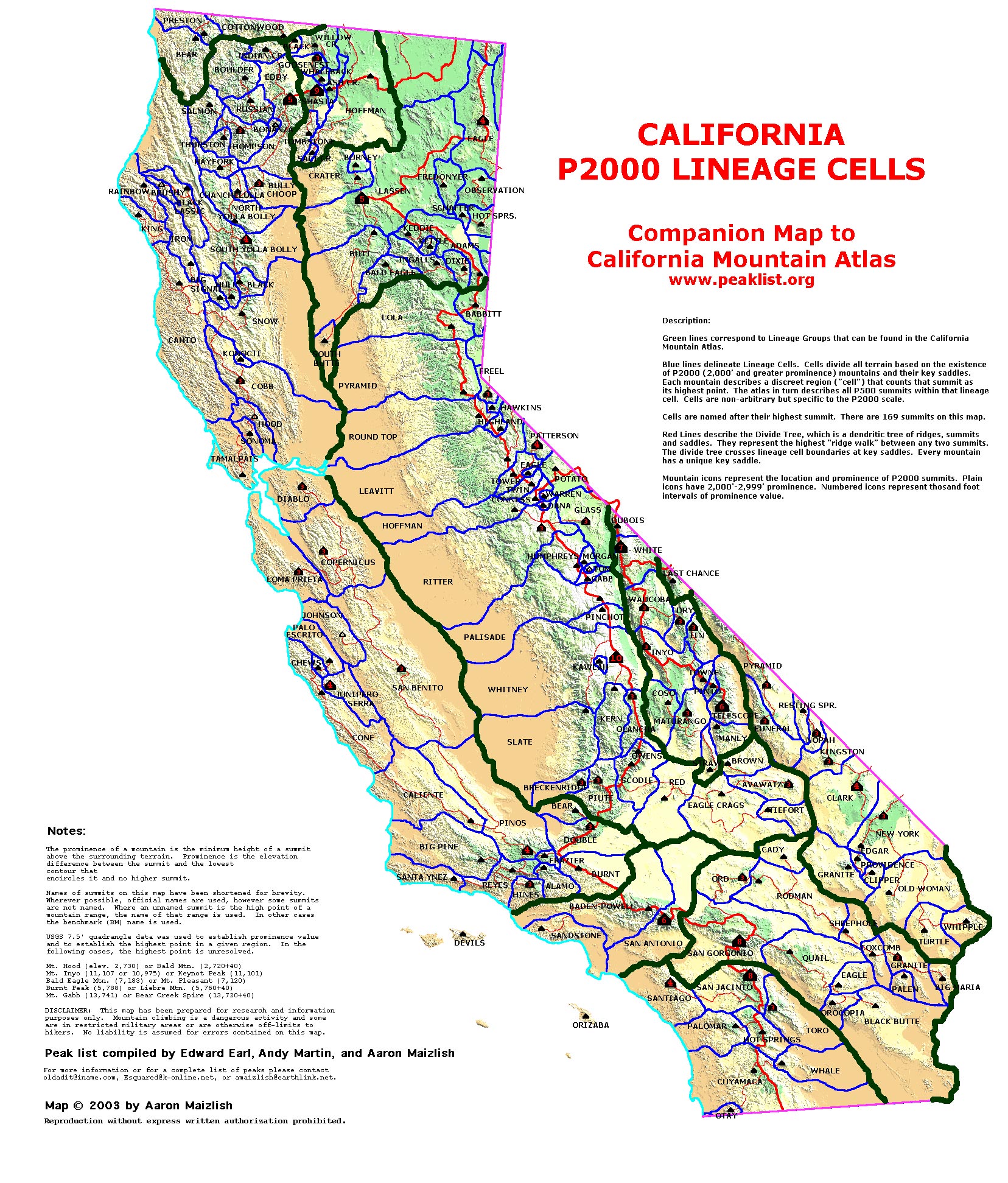
| California Cell Reference Map |
California
Mountain
Atlas Home Page |
Peaklist Home Page |
Notes
and Key to California Mountain Atlas |
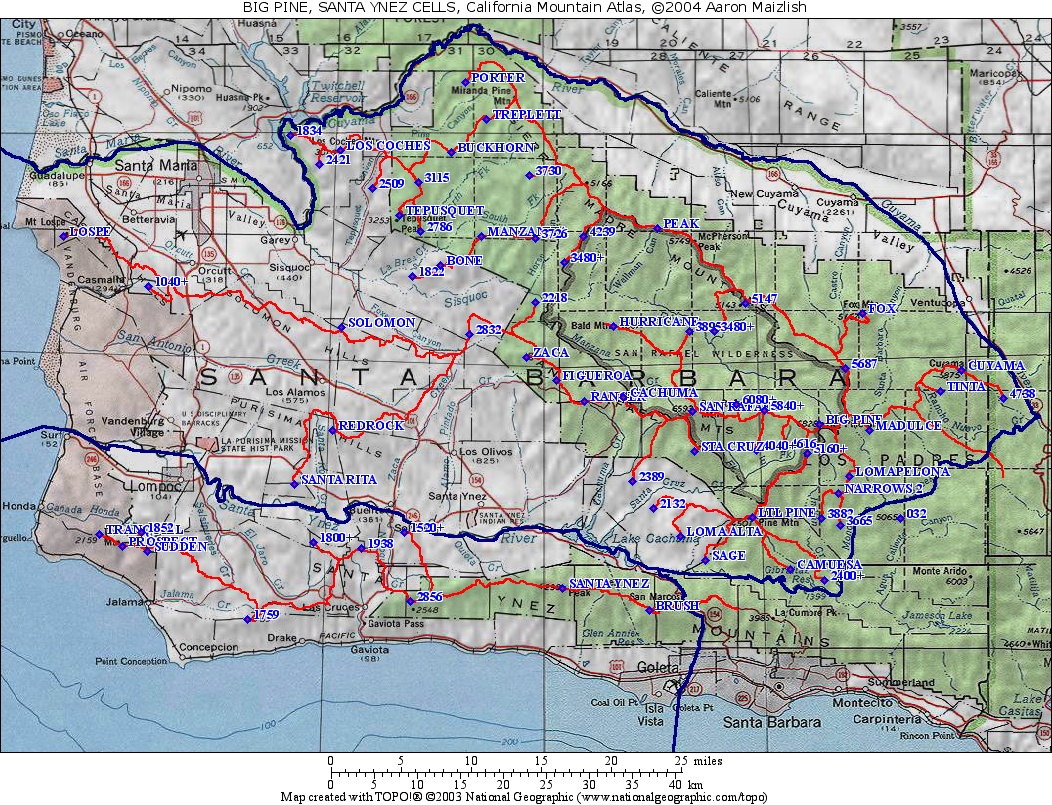
| Rank | Summit | Elevation | E(e) | Prominence | Saddle | S(e) | Lat. | Long. |
| 1 | Santa Ynez Peak | 4298 | 2074 | 2224 | 34º31'37"N | 119º58'42"W | ||
| 2 | Tranquillon Mtn. | 2159 | 1199 | 960 | 40 | 34º34'58"N | 120º33'40"W | |
| 3 | Pt. 1938 | 1938 | 938 | 1000 | 40 | 34º34'06"N | 120º13'54"W | |
| 4 | Sudden Peak | 2122 | 802 | 1320 | 40 | 34º33'56"N | 120º30'04"W | |
| 5 | Pt. 1800+ | 1800 | 40 | 720 | 1080 | 40 | 34º34'28"N | 120º17'28"W |
| 6 | Pt. 1759 | 1759 | 679 | 1080 | 40 | 34º29'40"N | 120º22'29"W | |
| 7 | Pt. 1520+ (mult.) | 1520 | 40 | 640 | 880 | 40 | 34º35'05"N | 120º10'37"W |
| 8 | Pt. 2856 | 2856 | 576 | 2280 | 40 | 34º30'47"N | 120º10'12"W | |
| 9 | BM Prospect | 1933 | 533 | 1400 | 40 | 34º34'13"N | 120º31'57"W | |
| 10 | Brush Peak | 3080 | 40 | 520 | 2560 | 40 | 34º30'14"N | 119º52'05"W |
| 11 | Pt. 1852 | 1852 | 508 | 1344 | 34º35'05"N | 120º30'30"W |