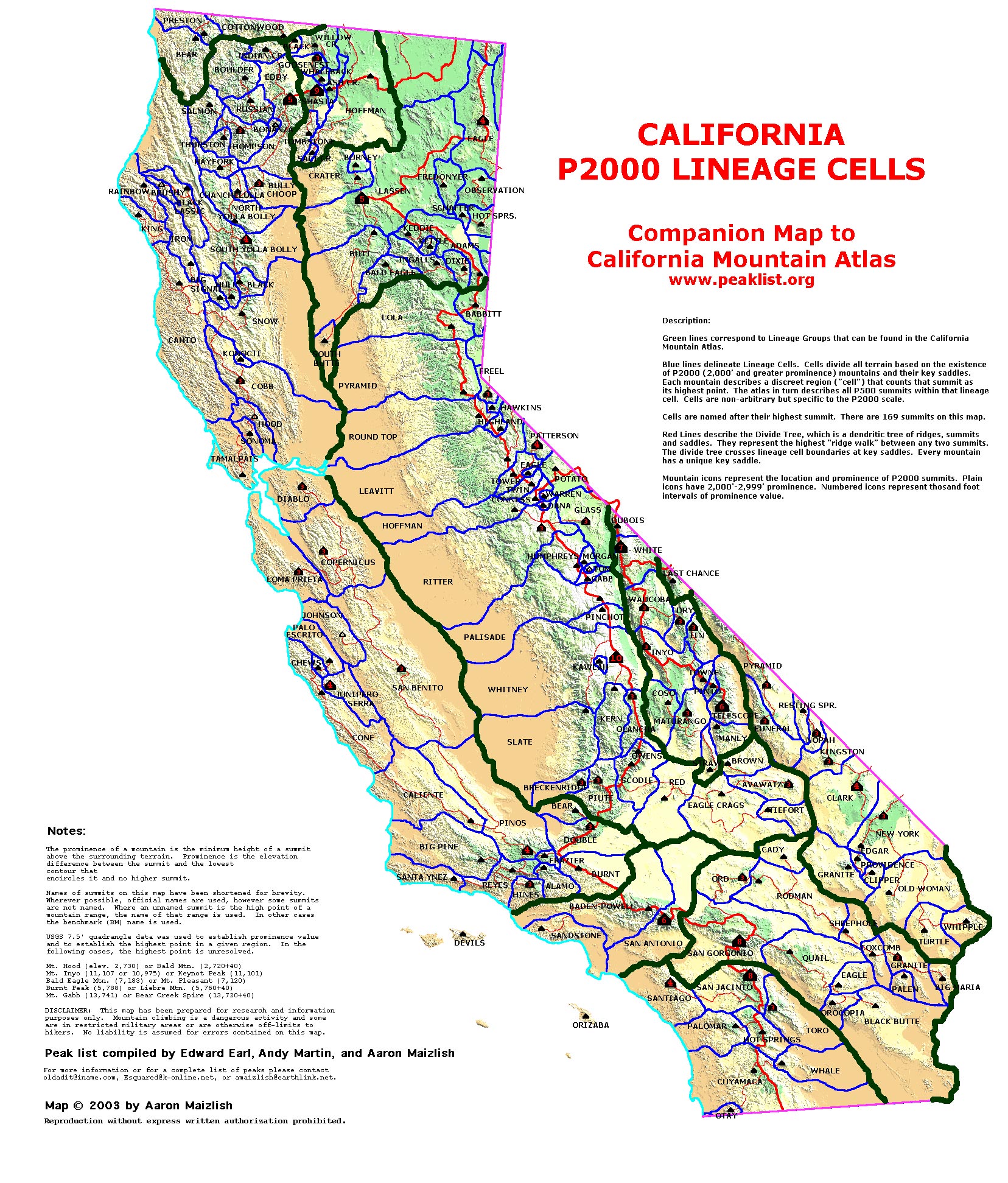
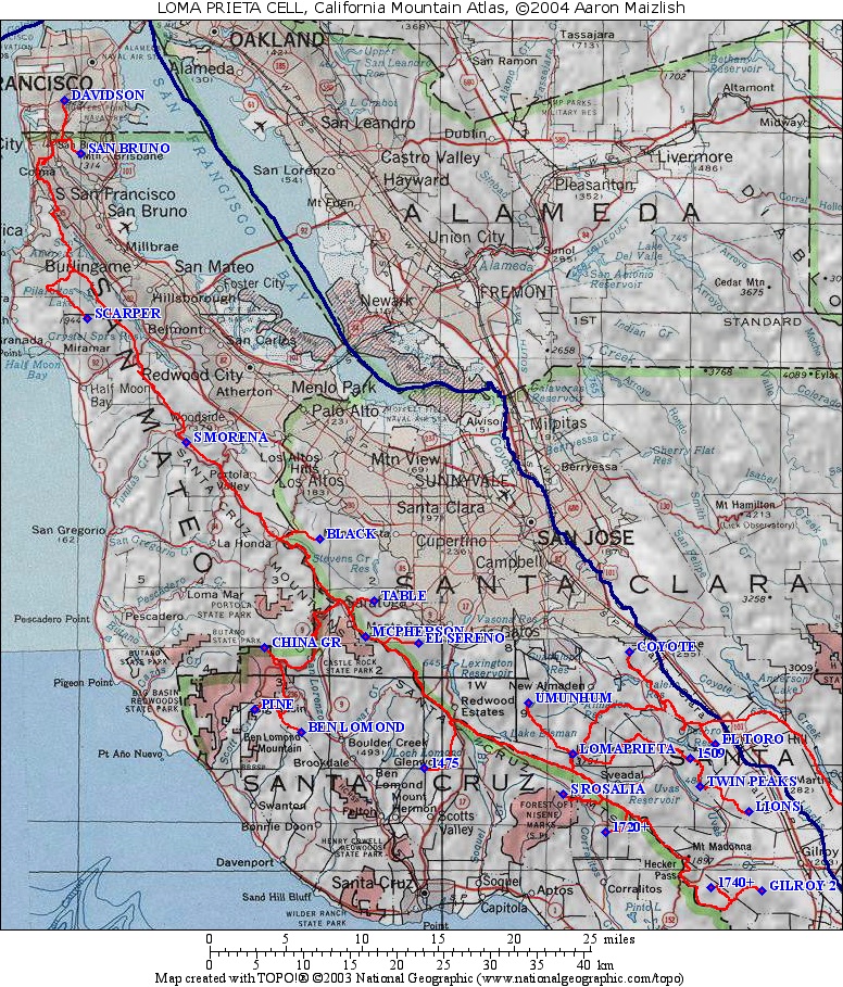
| California Cell Reference Map |
California
Mountain
Atlas Home Page |
Peaklist Home Page |
Notes
and Key to California Mountain Atlas |
| Rank | Summit | Elevation | E(e) | Prominence | Saddle | S(e) | Lat. | Long. | NHN500 |
| 1 | Loma Prieta | 3786 | 3426 | 360 | 10 | 37º06'40"N | 121º50'38"W | ||
| 2 | Mt. McPherson | 3231 | 1671 | 1560 | 40 | 37º13'25"N | 122º05'34"W | [2] |
|
| 3 | Ben Lomond Mtn. (mult) | 2642 | 38 | 1375 | 1267 | 37º07'55"N | 122º10'15"W | ||
| 4 | San Bruno Mtn. | 1316 | 1116 | 200 | 25 | 37º41'14"N | 122º26'08"W | [4] |
|
| 5 | Scarpet Peak | 1944 | 1104 | 840 | 15 | 37º31'44"N | 122º25'38"W | [5] |
|
| 6 | Sierra Morena | 2417 | 937 | 1480 | 40 | 37º24'38"N | 122º18'31"W | ||
| 7 | BM China Grade | 2359 | 908 | 1451 | 37º12'49"N | 122º12'55"W | |||
| 8 | Twin Peaks | 1552 | 883 | 669 | 37º04'47"N | 121º41'28"W | |||
| 9 | Pine Mtn. | 2208 | 808 | 1400 | 40 | 37º09'16"N | 122º13'36"W | ||
| 10 | Black Mtn. | 2800 | 40 | 720 | 2080 | 40 | 37º19'03"N | 122º08'51"W | |
| 11 | El Sereno | 2560 | 40 | 720 | 1840 | 40 | 37º13'03"N | 122º01'47"W | |
| 12 | El Toro | 1400 | 40 | 720 | 680 | 40 | 37º07'14"N | 121º40'24"W | |
| 13 | Lions Peak | 1117 | 697 | 420 | 10 | 37º03'24"N | 121º37'56"W | ||
| 14 | Santa Rosalia Mtn. | 2600 | 40 | 680 | 1920 | 40 | 37º04'21"N | 121º51'21"W | |
| 15 | Mt. Umunhum | 3486 | 657 | 2829 | 49 | 37º09'37"N | 121º53'53"W | ||
| 16 | Mt. Davidson | 927 | 630 | 297 | 22 | 37º44'19"N | 122º27'18"W | [16] |
|
| 17 | BM Gilroy 2 | 1860 | 20 | 600 | 1260 | 20 | 36º58'47"N | 121º36'59"W | |
| 18 | Pt. 1720+ | 1720 | 40 | 600 | 1120 | 40 | 37º02'10"N | 121º48'16"W | |
| 19 | Coyote Peak | 1155 | 595 | 560 | 40 | 37º12'33"N | 121º46'34"W | ||
| 20 | Table Mtn. | 2040 | 40 | 560 | 1480 | 40 | 37º15'31"N | 122º04'56"W | |
| 21 | Pt. 1740+ | 1740 | 20 | 560 | 1180 | 20 | 36º59'00"N | 121º40'39"W | |
| 22 | Pt. 1509 | 1509 | 549 | 960 | 40 | 37º06'26"N | 121º42'10"W | ||
| 23 | Pt. 1475 | 1475 | 515 | 960 | 40 | 37º05'53"N | 122º01'20"W |